× ×

Who We Are

× ×

About EA

× ×

Careers

× ×

Subcontractors/Suppliers

×
Marine Services

EA’s capabilities include sample collection and analysis, and environmental characterization in coastal and offshore waters.  We offer a wide variety of marine and aquatic survey capabilities and standalone oceanographic services

Capabilities

Seafloor and Seabed Characterization—EA employs optical, acoustic, and electromagnetic survey tools to conduct seafloor and seabed characterization projects, ranging from broad scale mapping of the continental shelf to obtaining the highest resolution and accuracies possible at a well-defined site within protected waters.

Geotechnical, Geochemical, and Biological Seafloor Sampling—Our capabilities include collection of surface, deep, and cross-sectional sediment samples as a means to evaluate the physical composition of the seabed and to ground-truth remote sensor data.

Physical/Chemical Oceanography—EA scientists obtains the highest quality physical and chemical oceanographic measurements.

Geodetic accuracy and repeatability in positioning are the basis for EA’s seafloor mapping and sampling services.

Services

EA’s marine resources services include:

  • Benthic Habitat Assessments
  • Bottom Boundary, Surface, and Water Column Current Measurements
  • Deeper Seabed Characterization
  • Fate and Transport Determinations
  • Hydrodynamic Modeling
  • Precision Bathymetry and Navigation
  • Sediment/Substrate Mapping
  • Submerged Aquatic Vegetation Mapping
  • Turbidity, Salinity, and Thermal Plume Monitoring
  • Water Column Profiling and Sampling
  • Wave and Tidal Measurements

Experience

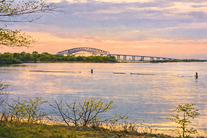
Photograph of open water in Bear Creek at sunset with the old Key Bridge in the background and the shoreline in the foreground

Bear Creek Investigation

EA was responsible for a multi-phase site investigation of soil, sediment, surface water, and groundwater. Our team developed tidally dynamic hydrology, hydrodynamic, and water quality models examining the fate and transport of contaminants discharged into Bear Creek.

Erosion along the shoreline of St. Croix Island

St. Croix Island

St. Croix Island experiences some of the highest tides in the world. EA, with support from Engineering With Nature® (EWN®) completed an alternatives analysis, feasibility study and conceptual design that described the data collection and modeling efforts that were completed to support the applicability and feasibility of NBS approaches for addressing impacts of coastal erosion and sea level rise on natural and built infrastructure.
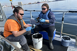
Two Scientists on a boat deck placing sampled sediment into containers to be sent to the laboratory for analysis

Masonville Dredge Containment

EA scientists collected samples to examine and conduct statistical evaluations on the benthic invertebrates and sediment chemistry located in the area around Masonville Cove, Maryland where dredged sediments from Chesapeake Bay are being placed in a dredged material containment facility. Collected benthic and epibenthic samples were collected, sorted and sent for analysis by a 3rd-party laboratory. The long-term monitoring program helps track potential impacts to the surrounding waters.
×

Contact Us

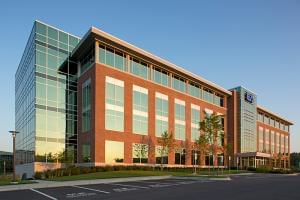
EA Engineering, Science, and Technology, Inc., PBC headquarters
Name