GIS Services
 EA provides GIS mapping and geospatial analysis support for our clients in the federal, state, and commercial sectors throughout the United States. GIS services include mapping products for field and reporting purposes and analysis for Phase I/II site characterizations, unexploded ordnance clearance activities, remedial investigations, hot spot mapping, and implementation of a customized electronic data collection system. By utilizing Esri’s ArcGIS software platform to build geodatabases for geospatial data development and client submittals, all GIS data delivered to clients meet Federal Geographic Data Committee (FGDC) Standards, which include populating relevant metadata fields and fully attributed data layers for military contracts. Additionally, all GIS data meet Spatial Data Standards for Facilities, Infrastructure, and Environment (SDSFIE) geodatabase compliance and provide geospatial information necessary for data uploaded to the Environmental Resources Program Information Management System (ERPIMS). Additional duties include report-quality figure production, differential GPS field data collection, and developing and maintaining GIS data management plans that address data inventory, development, maintenance, and storage procedures for all GIS data. EA employs a well-rounded staff of GIS analysts and managers, many with Geographic Information Systems Professional (GISP) certifications.
Tablet Program
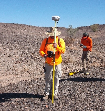
By combining GPS technology with an electronic field data collection system using tablets, EA has increased its efficiency in field data management. Multiple commercially available applications have been utilized to tailor the most appropriate interface to capture differing types of data. For 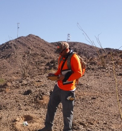 example, using ArcGIS software, customized field maps are uploaded to the tablets that can track location, provide customized data collection forms via the Collector for ArcGIS application, and capture images and video that are then synchronized to the cloud (on EA’s secure network), pooling all field data in one location. In addition to having data collected electronically and instantly uploaded to the cloud (thus continuously backed up), the tablets also serve as a repository for field identification guides, project work plans, and health and safety plans.
The tablets have been successfully implemented at a number of project sites. Below are a few examples of some of the larger projects that have utilized tablets:
- DoD Operational Range Assessment project locations throughout the United States
- DoD Military Munitions Response Program project locations throughout the United States (unexploded ordnance clearance reporting)
- Puchack Superfund Site Phase II
 Hudson River Polychlorinated Biphenyl Sediments
- Wetland Delineation Surveys throughout the United States
- Maryland Department of Transportation State Highway Administration Outfall Inspections.
Drone Program
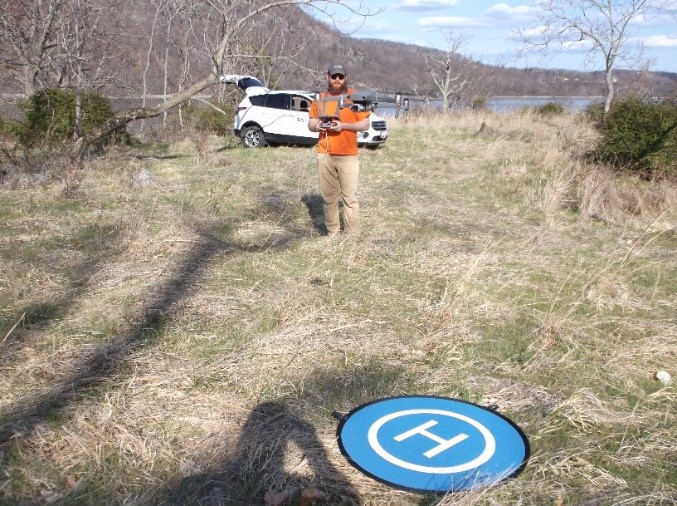
EA operates and maintains a drone program to capture high resolution aerial imagery and video. The drones we operate allow us to capture high quality real-time aerial imagery of a site in an efficient and safe manner. We have the knowledge and experience to fully plan and execute flight operations including developing a flight plan, placing and measuring ground control points, completing the drone flight, and processing the data.
EA can provide the following deliverables:
- Ortho-rectified aerials
- 3-Dimensional imagery
- Mapping grade topography
- 4k Video.
Our team of drone operators are fully insured and licensed to comply with the Federal Aviation Administration Part 107 guidelines. We can safely fly anywhere in the United States. We also have the knowledge to apply for Federal Aviation Administration waivers and authorizations as appropriate for restricted sites.