Location: Baltimore County, Maryland
Client: Baltimore County
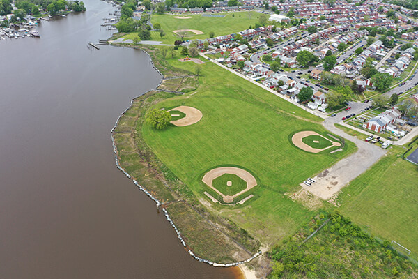
 EA assisted Baltimore County with evaluating alternatives and providing an engineering design to improve the shoreline stability at Inverness Park and Fort Howard Park, both active Baltimore County parks. EA performed both desktop data investigations and field investigations to assess both site’s susceptibility to shoreline loss, identification of potential shoreline enhancement alternatives to meet the project goals, and to provide sufficient data for site design. Field data included detailed field run surveys, bathymetric surveys, and geotechnical investigations. EA also prepared a detailed analysis to estimate wave conditions at the site utilizing hindcasting. Wave conditions were predicted as a function of historical wind speeds, existing fetch, and existing water depths. Fort Howard Park was determined to have a 34-mile fetch and accordingly, subjected to substantial wave energy. A wetland investigation and submerged aquatic vegetation survey were also performed to determine potential environmental impacts by the project. The design for Inverness Park consisted of approximately 1,500 feet of an imbricated riprap sill structure to reduce wave energy and to retain the sand placed behind it to create low and high marsh environments. The majority of the created marsh consisted of low marsh, and was proposed to be planted with plugs of smooth cordgrass (Spartina alterniflora). The design for Fort Howard Park consisted of a combination of 1,200 feet of offshore segmented breakwaters with tombolo formation and marsh creation, 2,900 feet of segmented breakwaters, 1,800 feet of hard sill with marsh creation, and the enhancement of an existing sill. The design addressed providing protection and function from the design wave energy to retain sand placed to create low and high marsh habitat.
