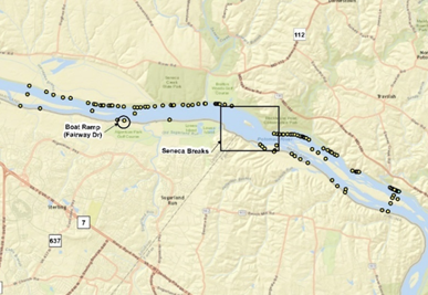
 National Park Service and the Washington Suburban Sanitation Commission requested a field survey to document the presence of Paspalum fluitans, a state protected species, along the Potomac River in the vicinity of a proposed new water intake. P. fluitans was discovered during an earlier survey of the project area, and the project team wanted to gain additional information on the species to better understand the context of potential impacts and the opportunity for recolonization of the species following construction.
Field surveys based on these targeted locations documented large populations both upstream and downstream of the proposed project. Geographic information system analysis using existing aerial maps, elevation data, and other habitat feature layers to screen habitat for P. fluitans in the study area revealed nearly 100 potential population locations. EA staff field surveyed one-third of the potential sites and identified populations in over 90% of the potential sites. EA was able to suggest natural seeding as the best course of action for mitigating the impacts of constructions to the floating P. paspalum population.
Detailed maps produced from the desktop analysis and field surveys will aid resource agencies in future surveys and management of this species.
