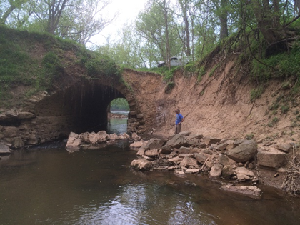
 EA worked with the National Park Service at four parks within the National Capitol Region to develop a comprehensive approach to identify wetlands, waterways, and riparian habitats for restoration, enhancement, and protection.
EA completed a desktop analysis to locate potential areas for restoration, based on previously mapped wetlands and wetland and stream data layers available from agencies, Maryland Historic Trust, as well as current, infrared, and historic aerial maps.
The desktop analysis identified 55 potential sites totaling 1,486 acres for review to field identify potential degraded wetland or stream areas. As part of ongoing and continuous coordination with National Park Service staff, EA held a workshop with National Park Service staff to identify concerns with potential sites or additional sites for consideration. As a result of this workshop, nine sites were removed, due to issues with ownership, easements, or access. However, a few new sites were added and some proposed sites were also expanded.
EA conducted a field review of the sites to ground truth assumptions from the desktop survey and determine if wetlands or streams were present. If present, an informal wetland delineation and wetland functions analysis were completed. EA developed project-specific field forms to streamline data collection and provide a standard approach for site assessment. These forms included a ranking system that allowed sites to be ranked and compared for restoration priority. All field collected data were entered into field tablets and linked directly to the GIS data for each site. EA’s desktop data analysis allowed for a greatly reduced field effort to accurately cover the four parks.
Finally, EA developed conceptual plans for restoration opportunities at each site. EA proposed wetland and stream restoration techniques that ranged in level of effort from removal of invasive species to full channel restoration. Restoration concept recommendations were tailored to each site. In all, the project resulted in the identification 42 potential sites, including 50 acres of potential wetland restoration and 20,000 linear feet of stream restoration. The final product provides a menu of options for potential restoration projects in these four parks that can be considered for restoration through mitigation, grant funding projects, and other means.
