EA, under contract to the USACE–Baltimore District, performed a multi-phase, land-based and underwater Military Munitions Response Program remedial investigation at two former rocket ranges on the Assateague Island Formerly Used Defense Site (FUDS). The former ranges comprised 6,660 acres that included the barrier island and the surrounding back bay and the Atlantic Ocean, now primarily managed by the National Park Service as a national seashore with a small portion of land managed by the State of Maryland as a state park. Prior to the remedial investigation fieldwork, EA prepared a UFP-QAPP including Accident Prevention Plan, Geophysical Investigation Plan, Explosives Management Plan, and Environmental Protection Plan. EA completed a Community Relations Plan and conducted Technical Project Planning meetings with stakeholders. To ensure the highest probability of detecting MEC both along the shoreline and in the ocean given the dynamic nature of the seashore, the MEC investigation was conducted using two mobilizations, with underwater fieldwork performed in the fall and land-based work completed the following spring.
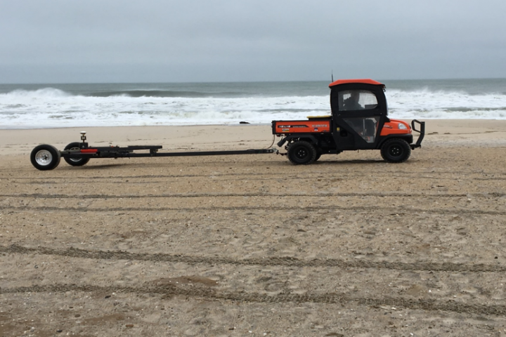
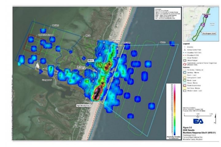
 Digital geophysical mapping (DGM) was performed in several different environments, including the ocean and marshes and along the beaches, dunes, and wooded interior of the island. The first phase of the investigation consisted of DGM transects across the shallow back-bay using a gradiometer suspended from a Jon-boat and DGM transects over the ocean floor using a deeper water vessel and a sled-mounted gradiometer. Following data processing, a high resolution digital geophysical map was produced to help select anomalies for further investigation by UXO divers that reacquired and intrusively investigated the anomalies. Over 17 linear miles of underwater DGM was collected and 149 targets of interest identified for intrusive investigation. A high percentage of the underwater targets were located during dive operations demonstrating the detection and positioning capabilities of the underwater DGM system to successfully meet project objectives. The second phase consisted of DGM transects across the island portion of the ranges using a Geonics EM61-MK2 deployed on a variety of platforms including person-portable, wheel-mounted, and towed behind a utility vehicle. As for the underwater phase of the investigation, following data processing and analysis, DGM anomalies were reacquired and intrusively investigated by UXO technicians to help characterize the risk from MEC for park workers and visitors. Vegetation removal was performed manually to allow DGM equipment to pass through the survey areas, while adhering to National Park Service policies to protect natural resources. Over 134 linear miles of land-based DGM and 1,440 targets of interest were identified for intrusive investigation. Survey areas included campgrounds, beaches and National Park Service maintenance areas, which required extensive coordination to prevent impacts to National Park Service operations. The majority of the work was completed offseason to avoid National Park Service operations, as well as threatened and endangered species.
 Overall, the DGM surveys met data quality objectives and successfully identified a target impact area at one of the rocket ranges, munitions debris (practice rockets) from suspected range disposal pits in the ocean, and confirmed that a second range was not used. EA completed the USACE Risk Management Methodology and concluded that there were Unacceptable Conditions at MRS 01 and MRS 03. Based on findings, no feasibility study was necessary, with significant cost savings to USACE. EA prepared No Further Action Proposed Plan and Decision Document which underwent state, National Park Service, and public review and received concurrence for No Further Action.
